The South Rim · Tusayan, Arizona

South Rimhelicopter tours.

Flights leave Grand Canyon Airport, just outside the park, and cross the canyon through two corridors. None of the flights we checked land.

North Canyon & Grand Kingdom · Tusayan departures

Tusayan & the South Rim North ↑
Colorado RiverNorth Rim
  • GCN Grand Canyon Airport Tusayan · South Rim 35°57′N 112°09′W
  • Grand Canyon Village 36°03′N 112°09′W

GCNGrand Canyon Airport · outside the park

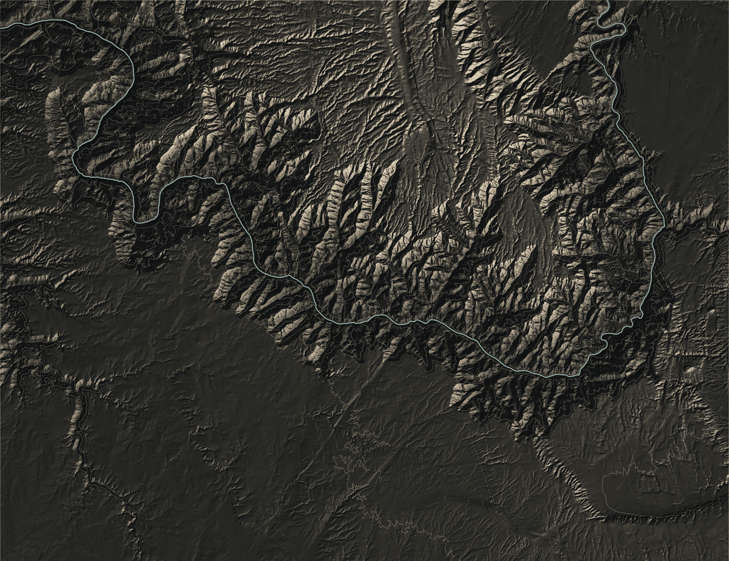
Airport locations, not flight paths. GCN is south of the park, in Tusayan.

Map key & sources

Dashed: National Park Service boundary.

Relief: USGS 3DEP / SRTM. Contours: 100 m. Water: USGS National Hydrography Dataset; mapped water extent is not a live reservoir shoreline. Scale at 36.14°N.

Airport reference points: FAA data via AirNav. Use your operator’s directions for check-in. Cartography by Helicopter Tour Finder; checked 10 October 2026.

This is a geographic guide. Airspace restrictions and individual tour routes are not plotted. See the FAA’s Grand Canyon chart for aviation information. Not for navigation.

The short answerNPS · FAA · Papillon

Choose by how long you want in the air

The National Park Service says all scenic air tours are based outside the park, and the South Rim’s are at Grand Canyon National Park Airport in Tusayan. Both Papillon flights we have checked return there without landing; one is about 25–30 minutes long and the other about 40–50.

Published flight durations

North Canyon

25–30minutes flying

  • Flying25–30 min

Your travel to and from Tusayan: allow extra time; no duration is published.

Grand Kingdom

40–50minutes flying

  • Flying40–50 min

Your travel to and from Tusayan: allow extra time; no duration is published.

Sources & research notes
Airport weatherTusayan— °F / — °C
At the departure airportsWeather observations
KGCN

Tusayan · Grand Canyon Airport

— °F / — °C

Observations unavailable

No current observation loaded

Airport weather is not a flight-status report. Your operator confirms any delay or cancellation. NWS forecasts

Tour sources · daily automated checks

Automatic check results are unavailable.

    Checks compare the duration and planning sections of three official Papillon pages with our reviewed records. A page check is not a flight-status report, a full editorial review, or a check of prices and availability. How monitoring works

    Across the canyonUSGS elevation data · 14 CFR 93.305

    Why the flights follow corridors

    Federal rules make four large areas over the park flight-free zones, three of them from the ground up to 14,500 ft. Commercial air tours cross the canyon through the gaps between them: the Dragon Corridor west of the Bright Angel zone and the Zuni Point Corridor to its east, each 2 nautical miles wide for tour flights. Papillon’s North Canyon description names the Dragon Corridor.

    Grand Canyon Village to the North Rim: cross-section Grand Canyon Village to the North Rim. Near rim about 6,970 ft, colorado river crossing about 2,410 ft, far rim about 8,220 ft. Heights are estimates from the elevation model.
    Colorado River crossing, about 2,410 ft Grand Canyon Village to the North Rim. The flights we cover stay above the rim. Airspace rules include corridors and altitude exceptions; this section shows terrain (14 CFR 93.305) Elevations from USGS 3DEP / SRTM along a straight transect. River crossing from USGS hydrography. Vertical scale exaggerated about 3.3×.

    The flights2 flights · Papillon

    Short or long, both round trips from GCN

    Two Papillon flights are covered here so far. Other tours are also sold in Tusayan.

    Tusayan to Inner canyon Papillon · HGG-1

    North Canyon

    The shortest way to see the inner canyon from the air if you are already staying near the South Rim.

    In the air

    Published flight duration

    25–30minutes flying

    • Flying25–30 min
    The view
    Inner canyon between the South and North Rims, including the Dragon Corridor and the Colorado River
    Before you fly
    Arrive 30 minutes before the flight. Travel to and from Tusayan is extra.
    Airport details & visit steps
    Departure
    Papillon South Rim terminal, Grand Canyon National Park Airport (GCN), Tusayan, Arizona · GCN, 6,609 ft elevation
    Transport
    Not listed among the inclusions: you make your own way to the airport in Tusayan. Hummer ground tours are a separate add-on.
    The tour name
    “North” describes what you see. The flight leaves from the South Rim side, not the North Rim.
    Keep in mind
    No landing, and the published 25–30 minutes is flying time only.
    Sources & research notes
    Tusayan to Eastern canyon Papillon · HGG-2

    Grand Kingdom

    A longer South Rim flight that adds the canyon’s eastern region, for people who want more time in the air.

    In the air

    Published flight duration

    40–50minutes flying

    • Flying40–50 min
    The view
    The canyon’s eastern region toward the North Rim, including the Colorado River
    Before you fly
    Arrive 30 minutes before the flight. Travel to and from Tusayan is extra.
    Airport details & visit steps
    Departure
    Papillon South Rim terminal, Grand Canyon National Park Airport (GCN), Tusayan, Arizona · GCN, 6,609 ft elevation
    Transport
    Not listed among the inclusions: you make your own way to the airport in Tusayan. Hummer ground tours are a separate add-on.
    Keep in mind
    No landing; plan for check-in on top of the 40–50 minutes of flying.
    Sources & research notes
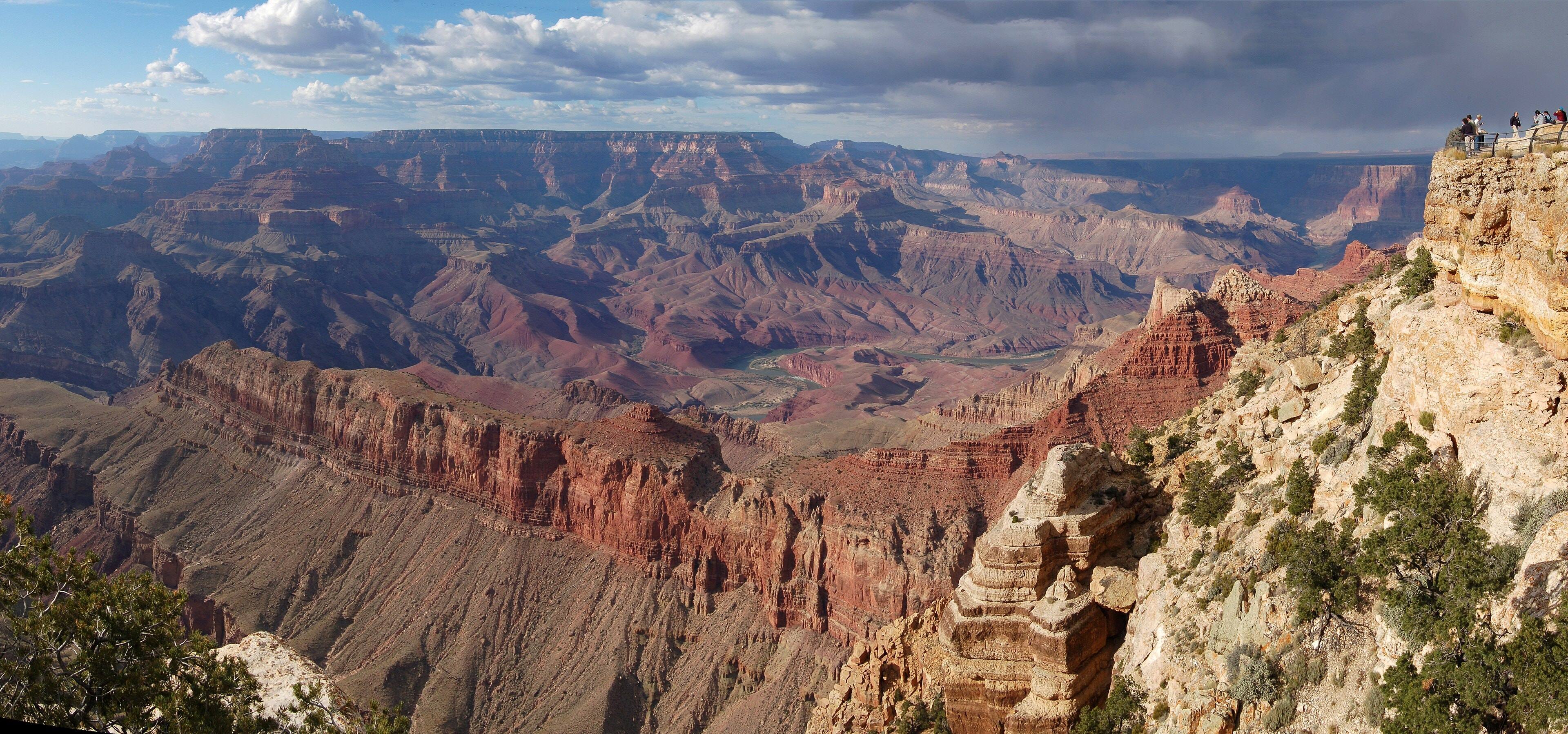
    Layered red and tan canyon walls seen from Lipan Point, with a bend of the Colorado River far below under a cloudy sky
    The Colorado River from Lipan Point, a South Rim viewpoint on Desert View Drive. Photo: Grand Canyon National Park (NPS), public domain.

    Before you goFour notes

    What the flight minutes don’t tell you

    1. Allow for check-in

      Papillon asks passengers to check in at the airport 30 minutes before the flight, on top of the published flying time.

    2. Get yourself to Tusayan

      Transport to the airport is not listed among the inclusions. How long the drive takes depends on where you stay.

    3. “North Canyon” starts in the south

      The name describes the views toward the North Rim. The flight leaves from the South Rim side and returns there.

    4. Las Vegas flights go somewhere else

      Canyon trips from Las Vegas usually visit Grand Canyon West, on Hualapai land outside the park. See flights from Las Vegas.

    Sources & research notes

    ContinueRelated pages

    Related pages

    1. North Canyon vs Grand Kingdom Comparison

      What the longer flight adds, and what stays the same.

    2. Flight time vs tour time Guide
    3. The departure chart: Las Vegas to the Grand Canyon Chart